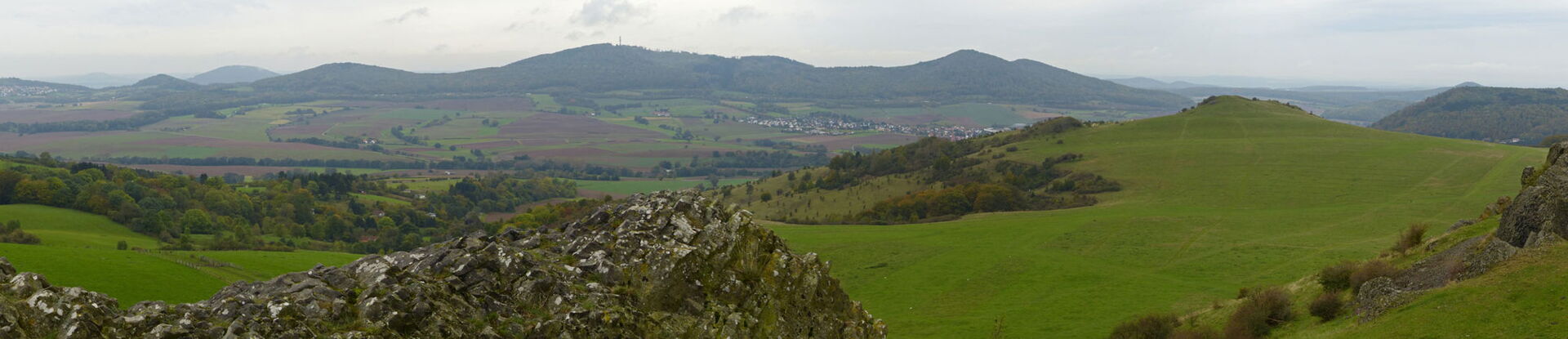

At 587 meters above sea level, the Hohe Dörnberg is the highest elevation in the Habichtswälder Bergland nature area and, together with the Helfensteinen, was designated a National Geotope in 2020.

Volcanism
About 15 to 13 million years ago, the area of today's northern part of Hessen was characterized by strong volcanic activity. The entire volcanic field of Lower Hesse is 5,000 km² in size and has about 500 volcanic centers with 2,000 eruption points and is thus probably the largest in Germany, whereby the greatest density of up to two volcanoes per km² can be reconstructed for the eastern part of the Wolfhager Land. It is about 400 km² in size. The landscape at that time could have been similar to todays on Lanzarote or Fuerteventura.
The Helfenstones at Dörnberg are formed by exemplary magmatic veins with horizontal pillars, which interpenetrate each other. They represent the cooled magma pulses into a volcano, probably a cinder cone, just below the paleo-land surface. The basaltic rocks, which may be termed limburgite, contain numerous xenoliths of the Earth's crust (including metamorphic rocks) and mantle.
More information about the guided tour is offered by the Habichtswald Nature Park!