Each border stands for a special period of the earth's history, for stages of evolution, for special natural or ecological phenomena and for important steps of historical and cultural development. Each border forms its own "GrenzWelten", which you can discover in the Geopark!
Geographical border: The Blue Ribbon of the Geopark
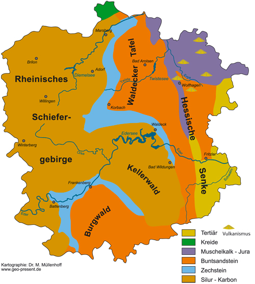
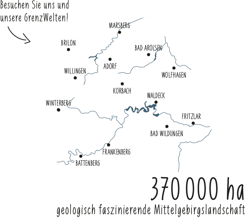
On the geological map, a blue band of limestone runs through the middle of the Geopark. Here you can find former coastal deposits from the Zechstein period. These not only separate the geopark into a geologically older western and younger eastern part, but also mark the border between ocean and land in the geological past - and a sea coast of the future!
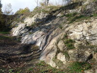
Geotectonic borders - Fresh springs from ancient rocks
Parallel to the blue band of limestone, the geopark is torn by deep tectonic faults. Fresh water rises to the surface here from ancient depths. Numerous healing and mineral springs between Volkmarsen and Bad Wildungen - economic and touristic foundations of our region - still bear witness to these geological elemental forces today.
Stratigraphic boundaries: Worth seeing locally - valid worldwide!

The Adorf cliff at the Martenberg is the type locality for the internationally valid division of the Devonian - it marks the boundaries of the "Adorfer Stufe". In various quarries the transgression of the Zechstein sea to the mainland is exposed - it marks the stratigraphic boundary between the Carboniferous and Permian geological ages.
Frontiers of Evolution: On the Trail of our Ancestors
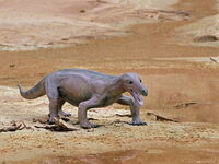
The fossil bones and teeth found in the Korbacher Spalte, above all the occurrence of the "Korbach Dackel" Procynosuchus, mark an important boundary in the evolution of the living world - the transition from reptile to mammal. Our oldest ancestors already lived in the area of the Geopark more than 250 million years ago!
Ecological boundaries: poor landscape, rich nature!
High heaths in the Upland, semi-arid grasslands on Zechstein and Muschelkalk, moors in the Burgwald and on the Waldecker Tafel, boulder heaps on Lake Eder - ecological and economic border regions that make the natural and cultural landscape in the Geopark so interesting and diverse.
Cultural borders: History from the Geopark
Celts and Germanic tribes, Franconians and Saxons, Waldeckers, Hesse and Westphalia - different languages, different architectural styles, different lifestyles have met in the area of the Geopark since the Iron Age. They still show their effect today: in the dialect (Ick-ich-Grenze), in the farm forms (Diemel Saxon farmhouse, Franconian three-sided farm) and in many other areas of the cultural landscape in the Geopark.