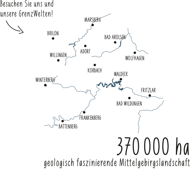

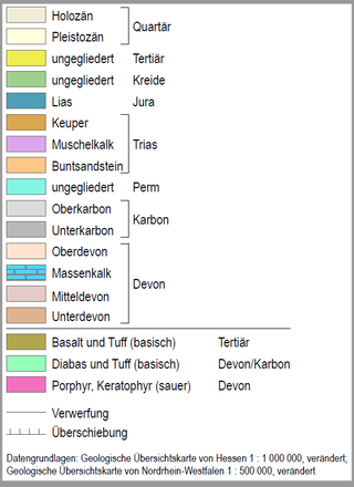
On the eastern edge of the Slate Mountains, Zechstein-age limestones mark a former seashore, running like a blue ribbon through the Geopark (blue). Extensive red sandstone landscapes (orange) in Burgwald and Nordwaldeck represent the beginning of the Mesozoic. Extinct volcanoes characterize the landscape in the "Wolfhager Land" (purple). Finally, the youngest rocks are found in the southwest of the park with the lignite deposits near Borken and the ice-age gravel deposits between Fritzlar and Wabern (yellow). The highest mountain reaches 843 m near Willingen (Upland), the lowest point in the Schwalm floodplain 159 m.